Sitting on the rugged border between Tennessee and North Carolina are the Great Smoky Mountains. They are a popular destination thanks to the exceptional natural beauty, diverse wildlife and plant life. Great Smoky Mountains National Park was designated as a UNESCO World Heritage Site in 1983, with over 1,500 species of flowering plants.
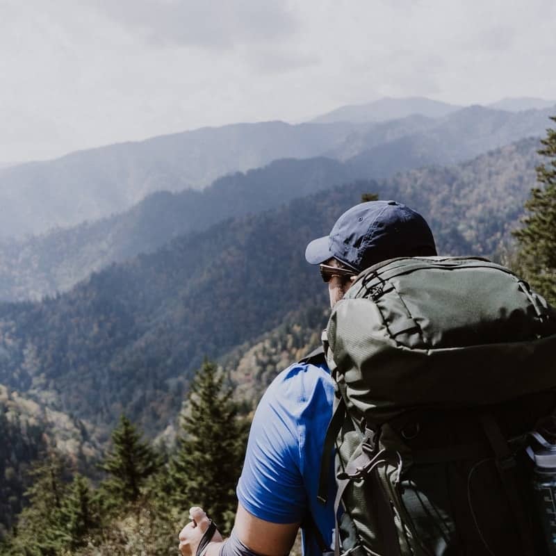
With more than 800 miles of trails running throughout this national park, including 71 miles of the Appalachian Trail, the Smokies are widely recognized as one of the best hiking destinations in the east of North America.
Here are 8 of the best hikes in the Smokies.
Tip: Great Smoky Mountains National Park does not charge an entrance fee, but a valid parking tag is required for any vehicle parked for more than 15 minutes. Buy parking tags in advance or at official park locations before heading to the trailhead.
Best Hikes In The Smokies
Gatlinburg Trail: Easy
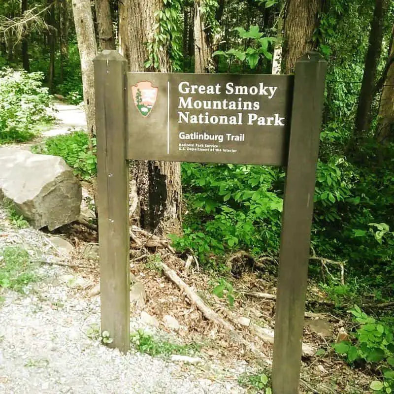
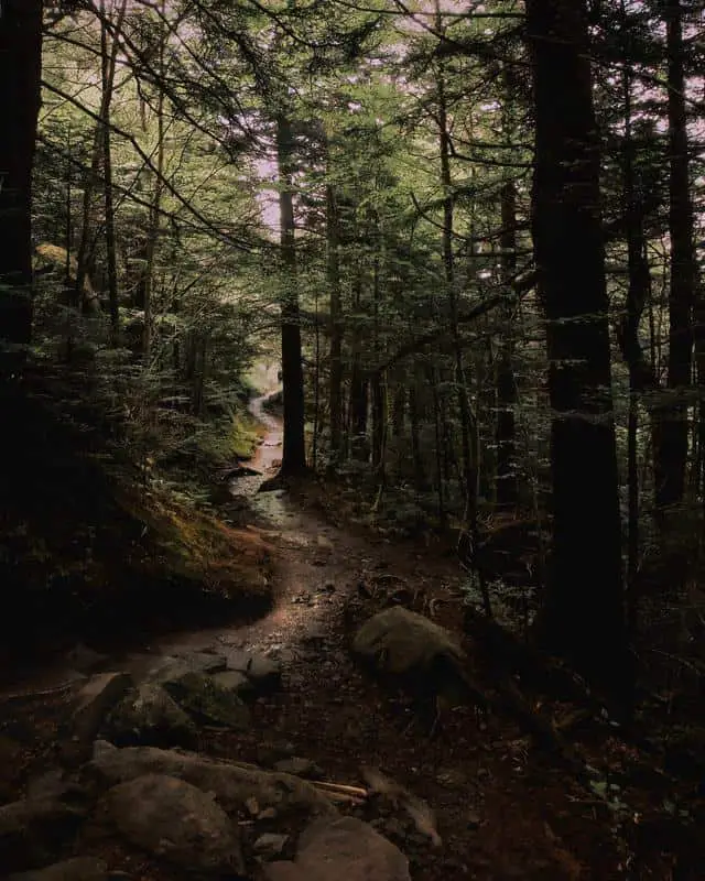
Enjoy a history-filled trail for all skill levels with the Gatlinburg Trail. This is one of the few trails that allow you to walk dogs on leashes and ride bicycles.
This trail follows the West Prong of the Little Pigeon River, ideal if you want to dip your toes in the water. After half a mile, the trail crosses over to a footbridge and a short climb. You will pass the remnants of an old homestead, which includes a chimney and interesting rock structures.
The woods beneath the Gatlinburg Bypass show remnants and reminders of the 2016 wildfire. 1.2 miles from the start of the trail, you’ll find a series of park maintenance buildings. Eventually, the trail disappears, and you’ll begin walking along the road. Follow a sidewalk to reach the visitor center.
Before reaching the Sugarlands Visitor Center, you’ll see a side trail that leads to Cataract Falls. This waterfall is only about half a mile away if you wish to take a quick detour. From this junction, the visitor center is only a short walk away.
- Location: Gatlinburg / Sugarlands Visitor Center
- Difficulty: Easy
- Miles: 3.8 round trip / 1.9 one way
- Elevation: 235
Read More: Best Things To Do In Gatlinburg
Kuwohi (Formerly Clingmans Dome) Trail: Easy

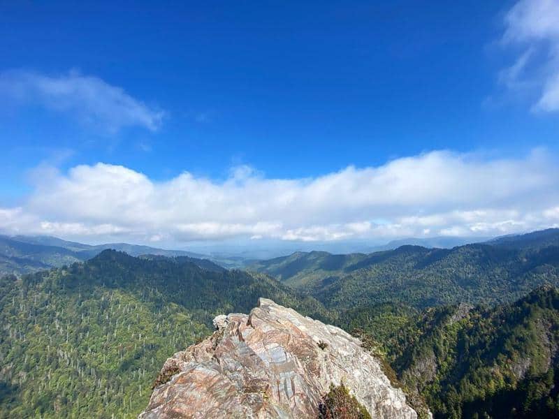
At 6,643 feet, Kuwohi, formerly Clingmans Dome, is the highest point in the Great Smoky Mountains National Park. On a clear day you can look from this mountaintop and see as far as 100 miles. Although it’s easy, the steep incline and 13% climb gradient may make it difficult for some. Thankfully, there are benches along the way to rest at.
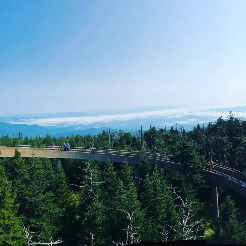
This place can be reached by traveling Kuwohi Road, formerly Clingmans Dome Road, which closes in winter and when conditions become unfavorable due to ice and snow. When the road is closed, hikers can still reach the area via longer hiking routes. The trail to reach the park’s highest point is paved and only measures half a mile long.
A benefit of the Kuwohi trail is that it intersects with several other hiking trails, including the Appalachian Trail, the Forney Ridge Trail and the Forney Creek Trail. These trails allow you to reach Kuwohi without having to travel the seasonal road.
Enjoy 360-degree breath-taking views of the Great Smokies from the summit. Perched above the tree line is an observation tower which allows hikers to enjoy panoramic views and stunning photo opportunities.
- Location: Kuwohi Road
- Difficulty: Easy
- Miles: 1 round trip
- Elevation: 332
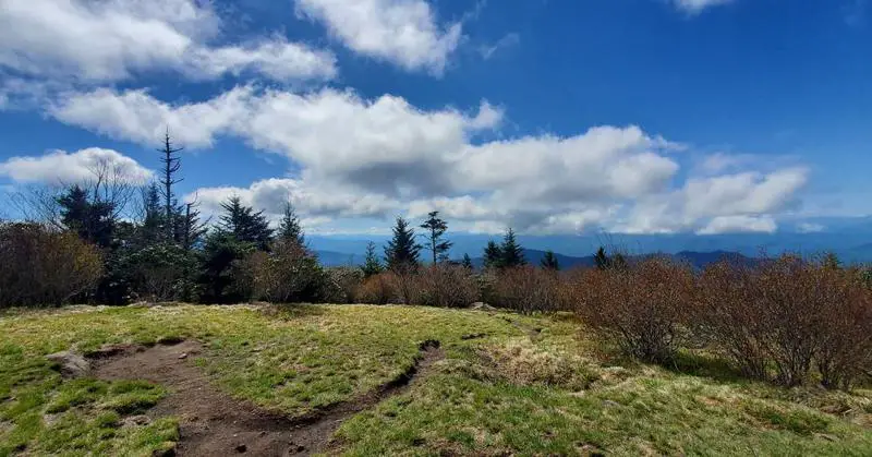
Andrews Bald: Moderate
The hike to Andrews Bald was previously known to be one of the most rugged and rocky hikes in The Smokies. In 2008, the Friends of the Smokies made some much-needed improvements to the trail. Flat stones were placed on the path and staircases were added out of native rock and locust wood to improve accessibility.
This is a good medium trail, as you can enjoy outstanding views of the Great Smoky Mountain highlands, a quieter walk, and a good length to keep the whole family amused. Because this is such a popular spot, we recommend starting earlier rather than later in the day.
Start the hike descending the southern flank of Kuwohi, formerly Clingmans Dome, also called Forney Ridge. Pass through a spruce-fir forest before the bypass trail branches off to the right. This connector path leads to the Appalachian Trail. To continue towards Andrews Bald hikers should turn left at this junction.
One mile from the trailhead, the Forney Creek Trail will branch off to the right. This trail eventually leads into Lakeshore Trail near Backcountry Campsite 74. From this junction, hikers should proceed straight ahead to continue to Andrews Bald. Around the outskirts of Andrews Bald, you’ll find several acres of open grassy meadow to picnic or to take in the panoramic views.
- Location: Kuwohi Area
- Difficulty: Moderate
- Miles: 3.5
- Elevation: 899
Alum Cave Trail: Moderate
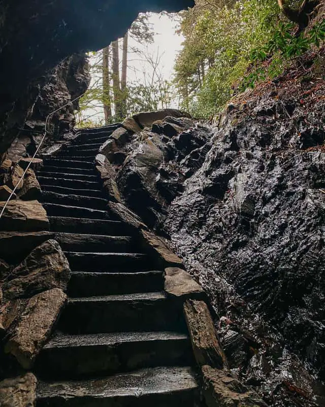
The hike to Alum Cave in the Great Smoky Mountains starts at the Alum Cave Trailhead on Newfound Gap Road. 1.3 miles from the trailhead hikers will find Arch Rock, the first prominent landmark along the trail. Freezing and thawing, which eroded with soft rock away from the harder rock formed this stunning arch.
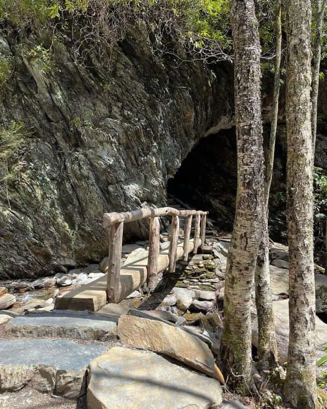
Follow the trail under the arch and climb up the steps etched into stone. From here ascend towards Alum Cave, enjoying views of the Anakeesta ridge. Two miles from the trailhead, you will find Inspiration point, a bald heath with offers scenic views of Little Duck Hawk Ridge to the west and Myrtle Point towards the northeast. A hole in the rock, called The Eye of the Needle, near the top of Little Duck Hawk Ridge, can also be enjoyed from this vantage point.
If you’re at the Sugarlands Visitor Center near Gatlinburg, you should drive 8.7 miles south along Newfound Gap Road, where you will find this trailhead. You’ll find the parking lot to your left-hand side. This spot is so busy we recommend arriving early during peak tourist seasons or during weekends with good weather, as the two parking lots can quickly fill up!
- Location: Newfound Gap Road
- Difficulty: Moderate
- Miles: 4.4
- Elevation: 1,125
Chimney Tops: Moderate-Difficult
Chimney Tops is one of the most popular hikes in the Smokies thanks to its short length and panoramic views, although it is very steep. Whilst the first half of the trail is relatively tame, hikers will have to climb more than 960 feet toward the overlook below the peak. This trail was restored in recent years after the 2016 wildfire in the area.
The first section of trail generally follows the cascading waters of the Road Prong Creek and crosses several footbridges along the 0.9-mile route to Beech Flats. The trail junction here marks the half-way point for this hike.
From here hikers can follow the Road Prong Trail which branches off to the left towards the Appalachian Trail at Indian Gap. This is one of the oldest trails in the Smokies. To reach the Chimney Tops, follow the main path which veers to the right.

To reach the Chimney Tops overlook you’ll have to stay on the main path, which veers towards the right. This course climbs roughly 730 feet over the next two-thirds of a mile where you can enjoy views of the mountains towards the east. The hike officially finishes about a quarter of a mile below the pinnacles for safety reasons.
Despite looking like a relaxed, low-mileage hike, novices should be warned that this is a strenuous hike.
- Location: Newfound Gap Road
- Difficulty: Moderate-Difficult
- Miles: 3.3
- Elevation: 1,487
Mt. Cammerer: Strenuous
This strenuous and difficult hike allows you to enjoy panoramic views of The Smokies. Although 11 miles sounds a long hike, it’s one of the shortest hikes to ascend Mt. Cammerer, a 4,928-foot mountain. Mt. Cammerer sits on the edge of a rocky outcropping looking over the Pigeon River Gorge. Enjoy stunning views on a clear day from this vantage point.
Hikers on this trail will climb the Low Gap Trail for three miles before reaching the Appalachian Trail. It’s a relentless climb, not one for the faint-hearted, with several switchbacks. You can head through a beautiful and mature hardwood forest before reaching the Cosby Creek valley.
The first part of this hike goes between Cosby Creek and the Cosby Campground. Crossing over with the Cosby Nature Trail, this hike starts at the campground, before hikers reach the Lower Mt. Cammerer Trail junction. There is an alternative path for reaching the Low Gap Trail, but hikers should use designated hiker parking and follow posted park guidance for campground access.
After two thousand feet and 2.9 miles, you’ll reach the Appalachian Trail. This part of the hike may be the hardest, but it’s the most beautiful, with wildflowers covering the forest floor. You will continue to climb, but the terrain isn’t as steep, and enjoy views over the Cosby and Tom Creek valleys. Although there is rugged terrain and some rock scrambling, it’s manageable.
- Location: Cosby
- Difficulty: Strenuous
- Miles: 11.1
- Elevation: 3,045
Related Read: Best Camping in The Great Smoky Mountains
Charlies Bunion: Strenuous
Charlies Bunion is a rock outcropping which offers outstanding views of the mountains to the north, Mt. Kephart and the Jump Off to the west, and Mount Guyot in the east. Due to the extremely steep drop-offs, this hike is better suited to those with some experience.
The hike to Charlies Bunion starts from the large Newfound Gap parking area. Hikers will need travel eastbound along the Appalachian Trail to reach this popular rock outcropping. This hike will allow you to enjoy views over the North Carolina Smokies and take in a beautiful selection of wildflowers in Spring and Summer.

Take in the breath-taking views of Mount LeConte and Myrtle Point before reaching the Sweat Heifer Creek Trail junction, about 1.7 miles from the trailhead. During some points in this hike, you’ll be traveling at elevations of 6,000 feet, allowing you to take in some of the best views.
Around 2.7 miles, hikers will reach the Boulevard Trail junction to Mount LeConte; continue on the Appalachian Trail towards Charlies Bunion. On your way, you will pass the Icewater Spring Shelter; do not drink untreated water from backcountry sources.
- Location: Newfound Gap
- Difficulty: Strenuous
- Miles: 8.1
- Elevation: 1,640
Also Read: Best Time to Visit Smoky Mountains
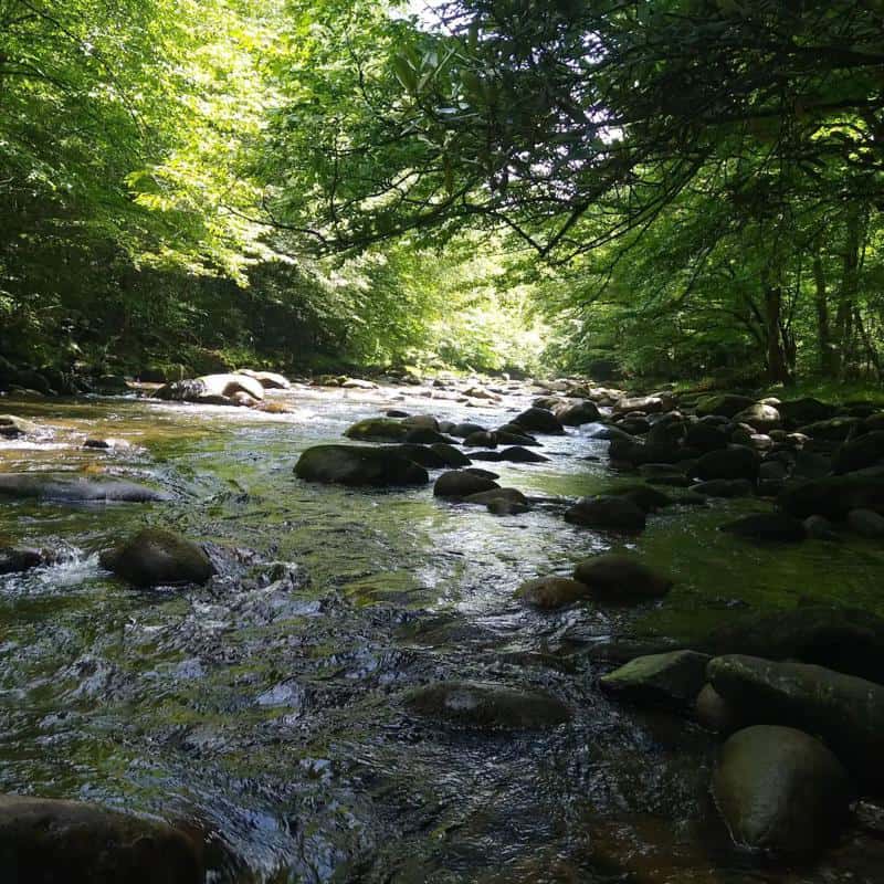
Middle Prong Trail: Strenuous
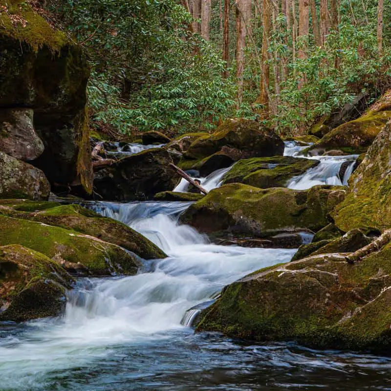
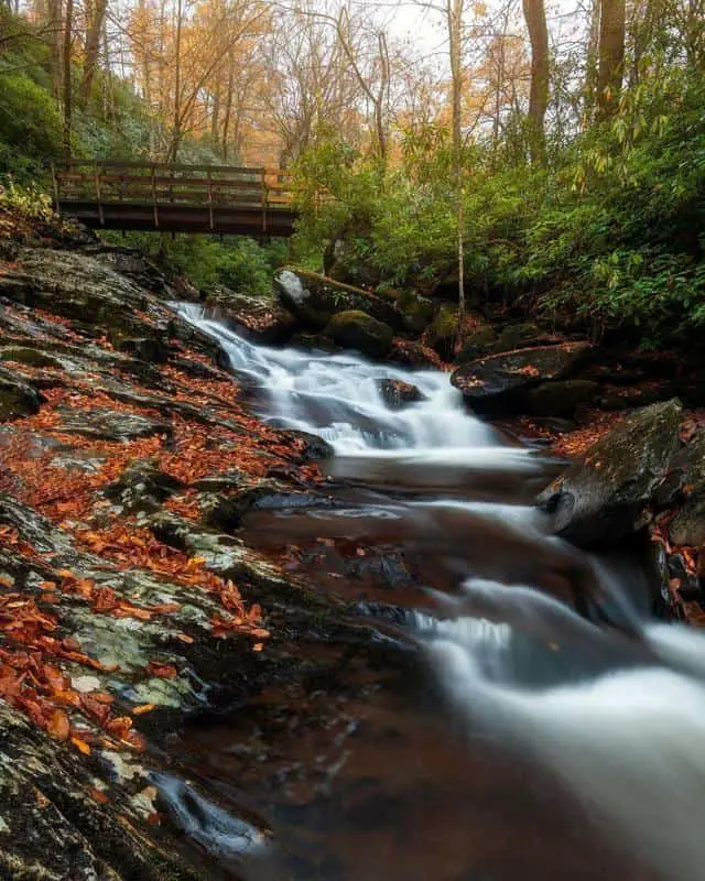
Middle Prong Trail is known to be the best hike if you want to see waterfalls. This trail passes through three major waterfalls, several smaller falls, cascades, and cataracts.
This trail starts at the confluence of the Lynn Camp Prong and the Thunderhead Prong, at the section where the Middle Prong of the Little River officially initiates. This may look like a gravel road, but it was actually a railroad bed used by a lumber company to haul logs out of the region. You will notice evidence of the Little River Lumber Company can be found around the area.
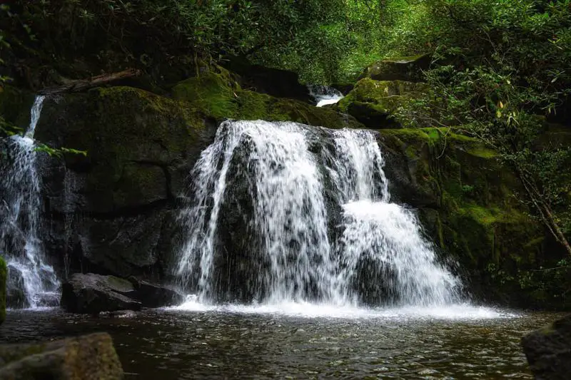
From the trailhead hikers will need to cross a metal footbridge over Lynn Camp Prong and shortly you will reach the Lower Lynn Camp Falls. This 35-foot, multi-tiered waterfall is one of the most impressive in the area. Head around the bend to enjoy stunning views of the upper section of the falls.
After passing the upper portions of Lower Lynn Camp Falls, check out the small cove that leads to a rocky area on the left-hand side. This very short side track allows hikers to enjoy a view of a hidden cataract. Two-thirds of a mile from the trailhead is the Lynn Camp Falls, another gorgeous, multi-tiered waterfall.
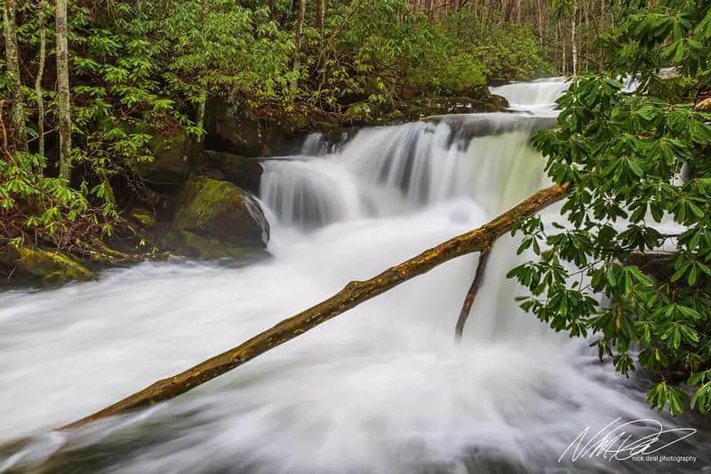
At 2.5 miles, hikers will reach the Panther Creek Trail, which leads to Jakes Gap. At 3.1 miles you will see a homestead on the left-hand side alongside old remains of pioneer and logging operations. Keep on going until you cross a footbridge and then, 4 miles from the trailhead, head to the right to see the Indian Flat Falls.
- Location: Tremont
- Difficulty: Strenuous
- Miles: 8.3
- Elevation: 1,140
Also Read: Best ATV & UTV Rentals in Smoky Mountains
FAQs
What is the weather like in The Smokies?
The weather can depend on the elevations of the park, which can range from 875 feet to 6,643 feet. Temperatures can vary 10-20 degrees Fahrenheit from mountain base to top, check out the elevation before you dress for the hike. It can get quite wet in The Smokies with rainfall averaging 55 inches per year in the lowlands to 85 inches per year at Kuwohi.
Can I camp in the Smokies?
Yes, there are a few locations where you can camp. There is the backcountry for backpackers to hike to, the frontcountry with restrooms and cold running water, large group campgrounds and horse camps. Reservations or permits are required for overnight backcountry stays and many developed campsites, so check the official campground and backcountry pages before planning a trip.
Final Words
So get those hiking boots on and enjoy some of the most stunning views whilst visiting to these hiking spots in the Smokies.