This post contains affiliate links. We may earn a small commission when you buy through our links — at no extra cost to you.
The moment I stopped trusting my phone on the trail came at a switchback junction in fading light: two bars of service dropping to none, and a battery drained from an afternoon of photos. A dedicated GPS device fixes that — it holds a satellite lock where cell service doesn’t exist, runs for days rather than hours, and works with wet gloves in the rain. What separates a good one from a frustrating one is how fast it grabs a signal, how readable the screen is in direct sun, and whether the menus still make sense when you’re tired.
Over the past seven months, my team and I carried 12 of these on local trails, through a wet week in the White Mountains, and on short afternoon loops where the only goal was beating dark back to the car. The surprise: more features rarely meant better navigation — the units that felt best were the ones whose basic screens I could read at a glance without breaking stride. The picks below are the ones that earned a permanent spot in the pack.



Best for Off-Trail Navigation
Garmin GPSMAP 65s
Key Features
- Maps: Routable TopoActive, U.S. public land
- Screen: 2.6 in color, sunlight-readable
- Battery: 16 hours, 2 AA
- Reception: Multi-band GNSS
- Price: Premium
Multi-band is the phrase worth understanding on this one. The 65s receives more than one frequency from each satellite, which is the difference between a position that holds steady in a steep, tree-covered drainage and one that drifts while you stand still deciding. Around that Garmin has built the most complete navigation package here: a 2.6-inch sunlight-readable screen, routable TopoActive mapping with U.S. public land boundaries, a three-axis compass, a barometric altimeter, and 16 GB of memory with a microSD slot.
We reach for it when the route stops being obvious. The positioning and the map detail are the strongest in this group, and the screen is large enough to read a contour line at arm’s length with the sun on it — the 2.2-inch displays on the eTrex units can’t match that. The compromise is endurance: a pair of AA cells gives about 16 hours, so a multi-day trip means carrying spares and swapping them at camp. On a day hike it’s a non-issue.
The other thing to budget is an evening. Garmin’s menu tree is deep, and setting up map layers, tracks and profiles at a trailhead is miserable; do it at home once and the buttons become quick. We think the 65s earns its place and its price for the trips where the map and a reliable fix are what keep you on route. If your hiking is mostly marked trail with the odd wrong turn, the eTrex 22x covers that for much less.
Pros
- Multi-band reception for steady fixes in steep terrain
- Routable TopoActive maps plus U.S. public land boundaries
- Biggest sunlight-readable screen of the mapping units
- Compass gives a bearing while standing still
Cons
- 16 hours on two AA cells is the shortest here
- Heaviest handheld here at 7.68 ounces
We recommend it to anyone whose routes leave the trail: multi-band reception, routable topo maps and the biggest screen of the mapping units here, in exchange for weight and a short battery.
Best for Everyday Trail Hiking
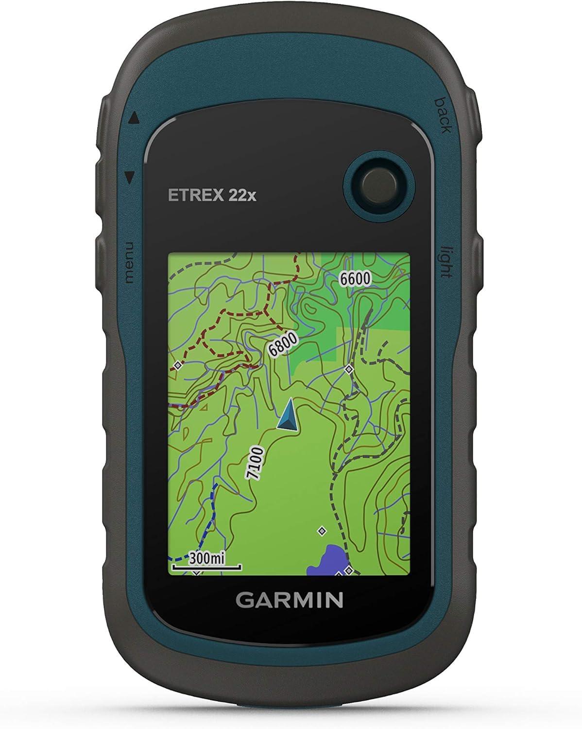
Garmin eTrex 22x
Key Features
- Maps: Routable TopoActive
- Screen: 2.2 in color, 240 x 320
- Battery: 25 hours, 2 AA
- Reception: GPS and GLONASS
- Price: Midrange
The 22x is the argument for spending less. It carries preloaded routable TopoActive mapping — the same map family the pricier eTrex 32x uses — on a 2.2-inch color screen, runs 25 hours on two AA cells, and weighs just under five ounces. That’s the same endurance as the 32x and more than the GPSMAP 65s, in a package that disappears into a chest pocket. It’s the unit we recommend to most people who ask what to buy for trail hiking.
What the money doesn’t buy is the sensor package. There’s no electronic compass, so the heading arrow only settles once you’re moving; at a junction you take a few steps and watch it swing. There’s no barometric altimeter either, which matters less unless you navigate by elevation. The screen is the other compromise: at 2.2 inches with a small cursor, reading contour detail is closer to squinting than scanning.
Controls are buttons and a joystick, which we came to prefer in cold weather and rain, and the menus stop being a puzzle after two or three outings. The 8 GB of internal memory takes a microSD card for extra map regions. If you want the compass and altimeter in the same body, look at the 32x and accept the extra cost; for everything short of that, the 22x is the value pick in this group.
Pros
- Routable TopoActive maps at a midrange price
- 25 hours on two replaceable AA cells
- Under five ounces and pocket-sized
- Button controls work with gloves and wet hands
Cons
- No electronic compass or barometric altimeter
- Small 2.2-inch screen with a fiddly cursor
We point most first-time buyers here: preloaded routable topo maps, 25 hours on two AA cells and a body that vanishes into a pocket, for a fraction of the top pick’s price.
Best for Budget Multi-Day Trips
Garmin eTrex SE
Key Features
- Screen: 2.16 in, 480 x 272
- Battery: 168 hours; 1,800 expedition
- Mapping: Via Garmin Explore app
- Reception: GPS, GLONASS, Galileo, BeiDou, QZSS
- Price: Budget
168 hours on two AA cells is the headline, and in expedition mode Garmin quotes 1,800. That is a different order of endurance from the rest of this group, and it arrives on the cheapest unit here. The screen is a 2.16-inch panel at 480 x 272 — sharper than the displays on the more expensive eTrex models — and the receiver tracks five satellite systems: GPS, GLONASS, Galileo, BeiDou and QZSS.
The catch is mapping. There’s no topo map set on the device — 28 MB of internal memory has no room for one — so the terrain view comes from the Garmin Explore app on your phone, while the unit itself gives you a basemap, a track and waypoints. We think that’s a fair trade for the trip where you’ve planned the line in advance and want a device that simply keeps running. It’s the wrong trade if you navigate by looking at the ground on a screen.
Two practical notes. The box holds the device and documentation, so there’s no clip or carabiner — budget for a mount if you want it on a shoulder strap. And the menus are not self-explanatory; give it an evening before the trip. The battery figure is the reason to buy it, and the screen resolution is the pleasant surprise.
Pros
- 168 hours on two AA cells, 1,800 in expedition mode
- Five satellite systems at the lowest price here
- Sharp 480 x 272 display
Cons
- No topo maps on the device; mapping needs the phone app
- No clip or mount in the box
We recommend it to hikers who plan the route at home and want a cheap device that runs a week on two AA cells — not to anyone who needs the terrain on the screen.
Best for Wrist-Worn Navigation
Garmin Foretrex 801
Key Features
- Screen: 2.2 in monochrome, 240 x 320
- Battery: 100 hours
- Sensors: 3-axis compass, barometric altimeter
- Reception: Multi-band GNSS
- Price: Midrange
There’s no topo map on the Foretrex 801, and that’s a design decision rather than an omission. What you get is a 2.2-inch monochrome screen, a three-axis compass, a barometric altimeter, multi-band reception and 100 hours of runtime in something that straps to your wrist and stays out of the way of your hands and your trekking poles.
It earns its place where stopping to unfold a handheld is awkward: steep off-trail ground, dense timber, a night leg where you want a bearing without breaking stride. The monochrome display is crisp in full sun and readable at a glance, and because the compass is three-axis and tilt-compensated, the heading holds while you stand still. At 5.5 ounces it’s noticeable on the wrist for the first hour and forgotten after that.
What you give up is the map. Routes are planned on a phone or a computer and followed on the wrist, and there’s no terrain view to consult when the trail fades. Two features tell you who this is built for: stealth mode stops the unit storing and sharing position data, and a kill switch wipes the memory. For most hikers those are curiosities; for some they’re the reason to choose it.
Pros
- 100 hours of runtime in a wrist unit
- Multi-band reception plus compass and barometer
- Crisp monochrome display, readable at a glance
- Stealth mode and kill switch for sensitive work
Cons
- No on-device topo map
- Route planning depends on a phone or computer
We recommend it to hikers who want the navigation on their wrist — a bearing, a grid reference and 100 hours of runtime — and who plan routes somewhere else.
Best for Long Sunny Trips
Garmin eTrex Solar
Key Features
- Screen: 2.2 in, 240 x 320
- Battery: 200 hours; unlimited in sun
- Charging: Solar panel and USB-C
- Reception: Multi-band GPS
- Price: Midrange
The solar panel on the front of this unit isn’t a gimmick, but Garmin’s unlimited-runtime claim deserves translating: it assumes 75,000 lux, which is bright, direct sun on the panel. In real hiking conditions, with the unit clipped to a strap under patchy canopy, you get a top-up rather than a free ride. The honest baseline is 200 hours with no sun at all, which is still the longest standard-mode figure here — and enough that charging stops being part of the daily routine.
The rest of the package is a sensible trail unit: a 2.2-inch high-contrast screen, buttons, multi-band reception for tighter fixes, and about five ounces in the hand. What it doesn’t have is a preloaded topo map set — 28 MB of memory, with detailed mapping coming from the Garmin Explore app — so think of it as a track-and-waypoint navigator with a trickle charger attached. Following a planned route on a long traverse, that combination is genuinely liberating.
If you want to see the terrain on the display, the eTrex 22x or the GPSMAP 65s do that and give up the panel. The Solar is for the hiker who has decided the route before setting out and wants the device to outlast the trip.
Pros
- Solar top-up extends runtime in bright sun
- 200 hours without sun, longest standard runtime here
- Multi-band reception at a midrange price
Cons
- No preloaded topo maps; 28 MB of internal memory
- Unlimited-runtime claim assumes direct, bright sun
We recommend it for long, sunlit trips where the route is already decided: solar top-up, multi-band fixes and the longest standard runtime here, with maps coming from your phone.
Best for Compass and Altimeter
Garmin eTrex 32x

Key Features
- Screen: 2.2 in color, 240 x 320
- Battery: 25 hours, 2 AA
- Sensors: 3-axis compass, barometric altimeter
- Reception: GPS and GLONASS
- Price: Midrange
The 32x is the eTrex 22x with two sensors added: a three-axis tilt-compensated compass and a barometric altimeter. The rest is familiar — the 2.2-inch color screen, 8 GB of internal memory plus a microSD slot, 25 hours on two AA cells, and preloaded routable TopoActive maps for roads and trails.
The compass is the part that changes a walk. A GPS heading only updates while you’re moving, so on units without one you take a few steps to find out which way you’re facing; with a three-axis compass the bearing is there while you stand still, which is exactly the moment you want it — at a junction, at a cairn, at the point where the trail stops being a trail.
The altimeter earns its keep if you navigate by elevation or watch the weather: a pressure trend gives you a hint that the day is turning, and the altitude reading is steadier than one derived from satellites alone. Neither sensor changes the screen, the menus or the battery, so you’re paying for the sensors and nothing else. Against the 22x, that’s a clear yes if you spend time off-trail, and a clear no if you don’t.
One housekeeping job: put a microSD card in before the first big map update. A full regional download runs for hours, and the card gives it room to land.
Pros
- Three-axis compass gives a bearing standing still
- Barometric altimeter steadies elevation readings
- Same routable maps and 25-hour AA runtime as the 22x
Cons
- Costs noticeably more than the 22x for two sensors
- Same small 2.2-inch display
We recommend it to hikers who want the eTrex 22x’s maps and battery with a compass and altimeter added — the upgrade worth paying for if you navigate off-trail.
Best for Sos Plus Mapping
Garmin GPSMAP 66i (Renewed)

Key Features
- SOS: inReach two-way messaging
- Maps: TopoActive plus BirdsEye imagery
- Screen: 3 in color, sunlight-readable
- Battery: 35 hours, rechargeable
- Price: Premium
Renewed is the first thing to understand here: this is a refurbished GPSMAP 66i with a 90-day warranty, not the year that comes with the new units on this page. What you get for that is the only device in the group combining a proper map with a rescue button — a 3-inch sunlight-readable color screen, preloaded TopoActive mapping with BirdsEye satellite imagery, and inReach two-way messaging and interactive SOS.
On a trip where a turned ankle is more than an inconvenience — solo, late in the season, past the last trailhead — that combination is worth more than every other feature here. The screen is the biggest of the mapping units and the 35-hour battery is the longest of them, so it isn’t a compromised navigator that happens to have a radio in it.
The caveats are real. Messaging and SOS need an active satellite subscription, a recurring cost the other devices here don’t carry, and the shorter warranty means you’re accepting more of the risk. Our advice is to test the messaging and download your maps at home, on the plan you’ve chosen, before this becomes the device you rely on above the treeline.
Pros
- Built-in inReach SOS and two-way messaging
- 3-inch screen, the biggest here
- 35-hour battery, longest of the mapping units
Cons
- Renewed unit with a 90-day warranty
- SOS and messaging need an active subscription
We recommend it to hikers who want a map and an SOS button in one device and are comfortable with a refurbished unit and a 90-day warranty.
How We Tested the Best GPS Devices for Hiking
We started by collecting specs for every handheld that hikers, hunters, and search-and-rescue volunteers actually recommend, then cut anything missing a real compass, a barometric altimeter, or a screen we could read in daylight. Price stayed in the conversation too, so a few budget picks stayed in the mix to see whether spending more bought anything beyond a bigger display. That left 12 devices, which we used for seven months.
Each one rode in the same hip pocket on the same routes as its competitors, so comparisons stayed fair: a four-mile loop after work, a longer weekend climb, and a week of hiking where the phone was useless. We timed satellite lock from a cold start, walked the recorded tracks back against known trail junctions to see how far the line drifted, and checked screen legibility with sunglasses on and the sun behind us. Every unit got handed to someone who’d never used a handheld, and we counted how long it took them to drop a waypoint.
Battery claims got their own test: we ran each device from full to shutdown with tracking on and the backlight fixed, then repeated it in cold weather. The solar models sat on a pack lid through full hiking days while we logged how much charge actually came back and whether it kept pace with a day of recording. We shared live tracks with someone at home, dunked each unit in a stream, and at the end argued over which ones we’d buy again with our own money.
How to Choose a Hiking Gps
The decision that shapes everything else is whether you want to read the terrain on the device’s screen or follow a route you planned at home.
Do you need a map on the screen?
A topo map on a two-inch screen is a route-following aid, not a planning tool. What preloaded mapping really buys is the moment the trail fades: instead of retracing a line, you can see the drainage on the far side of the ridge and pick a way across it. The GPSMAP 65s and the eTrex 22x ship routable TopoActive mapping; the eTrex SE, eTrex Solar and Foretrex 801 navigate from waypoints, tracks and bearings, with the detailed map on your phone.
The trap is reading "preloaded" as "complete". The public land boundaries on the 65s cover the U.S. only, a full regional topo download is a multi-hour job, and on the eTrex units it wants a microSD card in the slot. Trail walkers can get by on track and bearing; if you leave the trail, pay for the map first.
Reception where the sky is narrow
Three grades of reception appear in this group. GPS with GLONASS is the baseline and perfectly good above treeline. Multi-GNSS adds Galileo, BeiDou and QZSS, which means more satellites overhead at any given moment. Multi-band is the meaningful step up: receiving more than one frequency from each satellite keeps the fix steadier in steep country, under canopy, and in canyons where signals bounce off rock. The GPSMAP 65s, Foretrex 801 and eTrex Solar have it; the eTrex 22x and 32x don’t. We rate multi-band above every other upgrade on this list, but open-ground hikers can keep the money.
Hours, cells and cold mornings
Battery figures are the least trustworthy numbers on any of these boxes, because backlight, tracking interval and temperature all move them. The practical split is replaceable against internal. The AA units — 65s, 22x, 32x and SE — let you carry a spare pair and swap them in the cold; the GPSMAP 66i’s built-in cell means a power bank or a wall socket. Expect any quoted figure to fall in winter, and alkaline cells to fade first; lithium AAs hold their voltage better on a cold morning, which is the cheapest upgrade in this article.
Screen, buttons and weight
Screen size is a reading-distance question. The 65s’s 2.6-inch panel against the 2.2-inch eTrex displays is a real difference when you’re picking a contour line out at arm’s length with the sun behind you. Buttons beat touchscreens with gloves on and in rain, and every mapping unit here uses them — our preference too. Weight matters more than the spec sheet suggests once the device rides in a chest pocket all day: the eTrex units sit around five ounces, the 65s closer to eight, and a wrist unit stops being something you carry at all.
Compass, altimeter and the sensors worth paying for
A GPS heading only updates while you move. That’s why the three-axis compass is the sensor that changes how a unit feels in the field: the bearing is there while you stand still, which is exactly when you want it — at a junction, at a cairn, where the trail stops being a trail. The barometric altimeter adds an elevation trend and a steadier altitude reading. The 65s, 32x and Foretrex 801 have both; the 22x and SE have neither. Off-trail, the compass is worth paying for; on marked trails it’s a convenience.
Frequently Asked Questions
Do I need a subscription to use a hiking GPS?
No. Navigation runs off the satellite fix, with no plan and no phone signal — that’s the whole point of a standalone unit. Subscriptions belong to satellite messaging and SOS hardware: the GPSMAP 66i’s inReach features need an active plan, and that recurring cost belongs in the budget. If you only want maps, tracks and a bearing, plan for batteries and a microSD card instead.
How do I get a route from my computer onto the device?
Download the route as a GPX file, then move it across by USB or sync it through Garmin Explore or BaseCamp. Do it at home, on the device you’ll carry, and open the route once on the unit to confirm it arrived — a failed import is not something to discover at a trailhead. Extra map regions go on a microSD card.
Can I use one of these in the car?
Partly. The eTrex 22x and the GPSMAP 65s both carry routable roads alongside trails, so either will get you to a trailhead. The screens are small and the routing is built around hiking, so treat it as a backup for a road journey rather than a replacement for a car unit or your phone.
Final Verdict
The GPSMAP 65s is the device we hand to hikers who leave the marked trail: multi-band reception, routable topo maps with public land boundaries, and a screen you can read in the sun, traded against weight and a 16-hour battery. If your routes stay on trails, the eTrex 22x carries routable mapping and 25 hours for far less. And if you want the navigation on your wrist rather than in a pocket, the Foretrex 801 is the only one here built for it.