This post contains affiliate links. We may earn a small commission when you buy through our links — at no extra cost to you.
The trailhead sign said the loop was six miles; my phone said 12 percent. Half a mile in there was no service at all, and I spent the rest of the walk rationing battery instead of looking at anything. A handheld GPS fixes exactly that: it holds a satellite fix where cell towers don’t reach, keeps a tracklog running all day, and doesn’t quit because you forgot the power bank.
Over the past ten months our team has carried seven of these units on local day hikes, on a weeklong backcountry trip, and through more than a few muddy Saturdays of geocaching. The thing first-time buyers tend to miss is that a spec sheet full of satellite systems matters far less than whether you can read the screen in flat midday light and whether the battery is still going at hour nine. The picks below are the ones we’d hand to a friend.


Best for All-Round Hiking
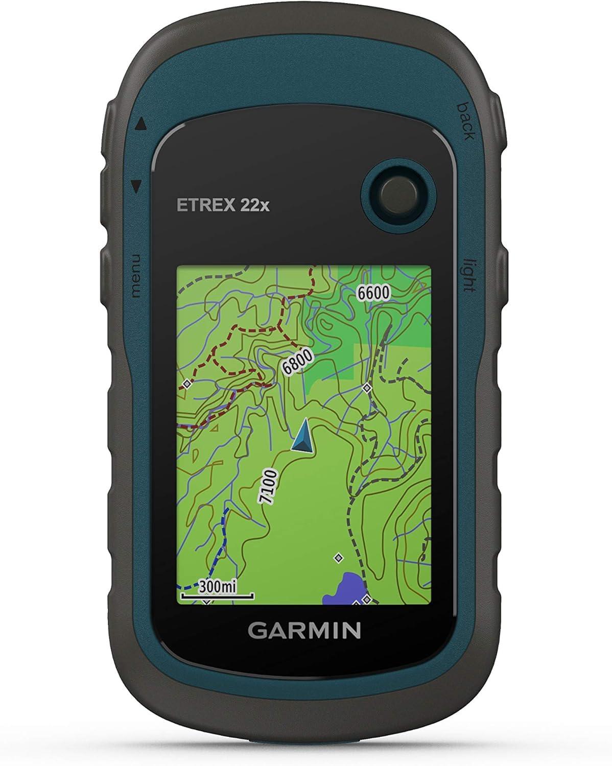
Garmin eTrex 22x
Key Features
- Memory: 8 GB plus microSD
- Screen: 2.2 in color
- Battery: 25 hours (2 AA)
- Preloaded maps: TopoActive, routable
- Price: Midrange
The case for the eTrex 22x starts with what is already in its memory: routable TopoActive maps of roads and trails, drawn on a 2.2-inch color screen. That distinction matters more than any other in this group. A unit with a basemap and nothing else can tell you where you are and which way the waypoint lies; a unit with topographic mapping shows you the ridge between you and it. Load a route and the 22x shows where the trail bends and how the climb stacks up before you commit to it.
Add 25 hours on two AA batteries, 8 GB of storage and a microSD slot, and you have the handheld we hand to most people who ask. The batteries earn their keep in ways a spec sheet does not capture: a spare pair in the pack weighs almost nothing, swapping them takes seconds with gloves on, and there is no charging cable to lose. At just under five ounces it disappears into a jacket pocket, which is where ours spent most of a season.
The screen is where the age shows. Two-point-two inches is enough for a track and a bearing, and the button-and-menu interface takes an evening to learn, so plan on sitting with it at home rather than in a trailhead parking lot. Once you have the logic, though, those buttons work through gloves and in rain, which is exactly what you want when the weather turns.
Pros
- Routable TopoActive maps preloaded
- 25 hours on two AA batteries
- microSD slot for map updates
- Pocketable at just under five ounces
Cons
- Screen washes out in direct sunlight
The handheld we point most hikers toward: routable topo maps already loaded, a color screen, and 25 hours on AA batteries you can swap anywhere.
Best for Off-Trail Accuracy
Garmin GPSMAP 65s
Key Features
- Screen: 2.6 in color
- Battery: 16 hours
- Sensors: 3-axis compass, barometric altimeter
- Satellite support: Multi-band GNSS
- Price: Premium
The GPSMAP 65s is the most expensive handheld here, so it has to justify itself with capability, and mostly it does: a 2.6-inch screen, multi-band GNSS reception, a 3-axis compass, a barometric altimeter and 16 GB of storage. The screen is the first thing you notice. Half an inch does not sound like much until you have tried to read a contour line on a 2.2-inch display by headlamp.
Multi-band is the real argument. Receiving across more than one frequency band lets the unit hold a position in the places a single-band receiver struggles: steep-sided valleys, dense canopy, the bottom of a canyon. The compass is the part we kept coming back to, because it keeps a bearing readable while you stand still, which is precisely when a movement-based heading is useless. The altimeter reads elevation from pressure rather than satellites, so it keeps working when the sky view does not.
One thing tempers it. Sixteen hours on batteries is the shortest runtime in this group, so spare cells belong in the kit rather than the emergency stash. That does not cancel the accuracy advantage. If you navigate off-trail, in winter, or anywhere a wrong bearing has consequences, this is the handheld to carry.
Pros
- Multi-band GNSS for tough terrain
- 3-axis compass and barometric altimeter
- Large 2.6-inch sunlight-readable display
- 16 GB of internal memory
Cons
- Heaviest carry here at 7.7 ounces
- Screen can blank and leave it unresponsive
We take this one off-trail: a bigger screen, multi-band reception, and an onboard compass make it the most capable handheld in this group.
Best for Long Trips
Garmin eTrex SE
Key Features
- Screen: 2.16 in color
- Battery: 168 hours (2 AA)
- Connectivity: Bluetooth, Explore app
- Satellite support: Five global systems
- Price: Budget
A hundred and sixty-eight hours is the number that earns the eTrex SE its place: a week of ordinary use on a pair of AAs, with expedition mode stretching a set of cells much further by turning off the screen and slowing the position log. On a long traverse, where every ounce and every spare battery is argued over, that changes the packing list more than any screen specification. It is the budget end of this group, and it does not feel like a penalty box.
What surprised us is the display: 480 by 272 pixels on a 2.16-inch panel is sharper than the larger screens on the GPSMAP units, and it stays readable in bright light. Trip planning, weather, geocache details and software updates come through the Garmin Explore app on your phone, and the receiver pulls from five satellite systems. Pairing is the part to do at home rather than at the trailhead, because the Bluetooth link can take several attempts to settle, and without an electronic compass your bearing comes from movement.
Set against the eTrex 22x, the SE buys enormous runtime and that sharper screen in exchange for map detail that lives on your phone rather than on the device. If your navigation is mostly a track log, a handful of waypoints and a return-to-start line, that is a fair trade. If you want to read terrain off the unit itself, pay for the maps.
Pros
- Up to 168 hours on two AA batteries
- Sharp 480 x 272 display
- Five global satellite systems
Cons
- No preloaded topographic maps
For long trips and cold mornings, this is the one we reach for: a week of tracking on two AA batteries and a screen that beats its price.
Best for Waypoints and Geocaching
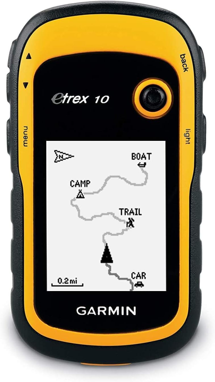
Garmin eTrex 10
Key Features
- Maps: Worldwide basemap
- Screen: 2.2 in monochrome
- Battery: 20 hours (2 AA)
- Waterproofing: IPX7
The eTrex 10 is the plainest unit here, and for one particular job that is exactly why we keep recommending it. What it gives you is a position, a track log and a waypoint list, on a body rated IPX7 waterproof that runs 20 hours on two AA cells. There is nothing on it to configure badly and nothing to distract you at the moment you need a coordinate.
That combination suits hunters marking a stand, scout groups teaching grid coordinates, and geocachers who want paperless cache pages without a phone out in the rain. It handles MGRS and grid-zone notation, which matters when you are reading coordinates off a paper map or a range card, and the buttons are simple enough to work one-handed in the cold.
The fit is narrow enough to be worth being honest about. Buy it when you want coordinates, a track and a waypoint list on a unit that survives being dropped on rocks and fed gas-station batteries. If you want to read terrain off a screen, the eTrex 22x is the step up and the extra money is well spent.
Pros
- IPX7 waterproof rating
- 20 hours on two AA batteries
- MGRS and grid-zone coordinates
- Paperless geocaching built in
Cons
- No topographic maps or routable roads
- Quick-start sheet only, no full manual
We like it for pure coordinate work: tracks, waypoints, and paperless geocaches on a waterproof unit with 20 hours of runtime.
Best for Accuracy, No Sensors
Garmin GPSMAP 65

Key Features
- Screen: 2.6 in color
- Battery: 16 hours
- Preloaded maps: TopoActive plus federal land
- Satellite support: Multi-band GNSS
- Price: Midrange
The GPSMAP 65 is the 65s with the sensors left off, and that is most of the story: the same 2.6-inch screen, the same multi-band receiver, and the same preloaded TopoActive mapping with federal public-land boundaries, in a body that costs noticeably less than its sensor-equipped sibling.
What the receiver buys you is a position that holds under canopy and in steep country, and the bigger screen makes that position readable at a glance rather than a squint. The public-land boundaries are a quiet convenience for anyone camping near the edge of a designated area, since knowing which side of the line the tent sits on is the sort of question this unit answers without a second device.
So the 65 makes sense for a specific buyer: someone who already navigates with a baseplate compass and wants multi-band accuracy without paying for sensors. If you have never worked a bearing off a paper map, the 65s is the safer purchase, because its compass earns its keep the first time you need a heading while standing still.
Pros
- Multi-band GNSS reception
- 2.6-inch sunlight-readable color display
- TopoActive plus federal land boundaries
Cons
- No compass or altimeter
- 16-hour battery life
We rate it for the navigator who already carries a compass: multi-band accuracy and a big screen, without paying for sensors you will not use.
Best for Compact Trail Backup
Garmin eTrex 32x

Key Features
- Screen: 2.2 in color
- Battery: 25 hours (2 AA)
- Sensors: Compass and elevation
- Preloaded maps: TopoActive, routable
- Price: Midrange
Map updates are the step that catches people out on the eTrex 32x. Its internal memory does not have room for a full topographic update, so a microSD card you supply becomes part of the process, and the download and install run long enough that you want it done the night before a trip rather than in the car on the way.
Get past that and the hardware is familiar: a 2.2-inch color screen, routable TopoActive maps, 25 hours on two AAs and the same pocketable sub-five-ounce body as the eTrex 22x, with compass and elevation readouts added. Those readouts are the reason this model exists next to the cheaper 22x. On a bushwhack they are the difference between knowing which way you are facing and walking in a circle to find out.
Where it gets awkward is positioning. It costs more than the 22x for the same screen and battery, and the GPSMAP 65 offers a bigger display and multi-band reception for about the same money. Our take: take the 32x when the compass and elevation matter and the screen size does not, and skip it if you are weighing it against the 65 on price alone.
Pros
- Compass and elevation readouts
- 25 hours on two AA batteries
- Routable TopoActive maps preloaded
Cons
- Screen hard to read in bright light
Choose it when a compass and elevation reading matter more than screen size; the maps and battery are the same as the cheaper eTrex 22x.
How We Picked and Tested Handheld GPS Units
We started by pulling every current handheld from the major outdoor brands and sorting them by what actually separates one from another: screen size, AA versus rechargeable power, topographic map support, and price weighed against what you get for it. That narrowed the field to seven units, which we carried for ten months.
Testing happened where these devices actually live: marked day hikes, a weeklong backcountry trip where the GPS was our only navigation, an afternoon of geocaching with kids, and a cold, rain-soaked walk we would otherwise have skipped. We recorded a tracklog on every outing and laid it over the same route walked with a second unit, noting where distance and elevation drifted and whether the arrow held steady or wandered.
Battery life got timed, not estimated — a full day of continuous tracking at medium backlight, then again at the brightest setting. We counted the button presses needed to load a route in the field without the manual, worked every menu with gloves on, and read the screen at noon and again at dusk. Durability came down to drops onto rock, a dunk in a stream, and one accidental ride in a pack pocket full of keys.
Each unit was judged on one question: does it do a job my phone can’t, well enough to justify the extra weight in my pack? Every pick below earns its place with something concrete — a battery you can swap on the trail, a track that didn’t wander, or menus you can work with cold hands.
How to Choose a Handheld Gps
Two specifications decide whether you end up happy with a handheld GPS: the map data already on it, and the cells that keep it running. Everything else is a refinement.
Preloaded topo versus basemap
Nearly everything in this category is sold as a GPS navigator, and that phrase tells you nothing about what appears on the screen. A preloaded TopoActive set gives you roads, trails and contours you can route along. A basemap gives you a coarse outline of the world and little else: enough to show where you are, not enough to show what sits between you and the waypoint. If you plan to read terrain, make topographic mapping a requirement. The eTrex 22x, eTrex 32x and both GPSMAP units carry it; the eTrex 10 does not.
The trap is a low price sitting next to the words preloaded maps. Read what kind, and read which region. A unit that covers somebody else’s continent is a paperweight on your trip until you buy and load the right card.
How much satellite support you need
All of these units receive GPS, and most add GLONASS. The GPSMAP 65 and 65s go further with multi-band reception, which holds a fix better in steep valleys, deep canopy and canyon country. On open, signed trails a single-band receiver is fine and your money is better spent on screen and battery. The moment you route-find through timber or winter terrain, the extra bands stop being marketing: they are the difference between a track that follows the trail and one that wanders across it.
Compass and altimeter: when they earn their price
A GPS heading only exists while you are moving, which is why an electronic compass matters. It gives you a bearing standing still, at a junction, in fog, or the moment you stop to check the map. A barometric altimeter reads elevation from air pressure, so it keeps working in a gorge where the sky view is blocked and stays steadier than a satellite-derived altitude.
Neither is essential for trail walking. They earn their price off-trail and in winter, and they are the reason the GPSMAP 65s and the eTrex 32x sit above their cheaper siblings. If you navigate by track log and marked junction, skip them and spend the difference on batteries.
Battery life, cells and cold weather
Quoted runtimes assume standard mode and mild weather, so treat every figure as a ceiling. The spread here runs from 16 hours on the GPSMAP units through 20 to 25 on the eTrex models up to 168 hours on the eTrex SE, and the long numbers come with a trade: expedition mode keeps logging your track but turns off the screen and slows the position fixes.
Field-replaceable AA cells are the practical choice for multi-day trips. Spares are light, cheap and available anywhere, and swapping them takes seconds. In freezing conditions, lithium cells hold voltage far better than alkaline, so pack those for winter.
Screen size, sunlight and the interface
Just over two inches is the class standard and enough to read a bearing; 2.6 inches makes a contour map legible at arm’s length. Sunlight performance matters more than size, and several units here still wash out at midday, so plan on shading the display with your body or hand. Buttons beat touchscreens with gloves on and in rain.
Budget an evening for the menus as well. These are deep, jargon-heavy interfaces, and the printed documentation that ships with them is thin. Learning the button logic at the kitchen table is far easier than learning it in a parking lot at dusk.
Frequently Asked Questions
Do I still need a handheld GPS if my phone already has maps?
For day hikes on marked trails, a phone is enough, and offline maps work without a signal. A handheld earns its place when the trip runs longer than a phone battery, when temperatures drop, or when the phone has to stay charged and dry for photos and emergencies. A pair of AA cells buys you another 20 hours or more of navigation, and dropping the unit on a rock is not a disaster.
If you only hike in summer on signed trails, keep the phone and put the money toward a power bank instead.
Are handheld GPS units waterproof?
Check the rating instead of assuming. The eTrex 10 carries an IPX7 rating, which means it survives a dunking. The other units here are built for wet weather but do not state an immersion rating, so treat them as rain-resistant and keep them out of the puddle at the bottom of your pack.
A zip bag costs nothing and settles the question on a wet trip.
Will a handheld GPS work outside the U.S.?
The hardware will; the maps may not. The GPSMAP 65 and 65s ship with North America mapping and U.S. public-land boundaries, and the eTrex TopoActive sets are regional too. A trip abroad means loading regional map data onto a microSD card before you fly.
Buy the regional card with the device rather than at the airport, and test the load at home while you still have a computer and time.
Final Verdict
Most people should buy the Garmin eTrex 22x. Routable topo maps are already on it, it runs 25 hours on two AA cells you can buy anywhere, and the memory card slot keeps map updates from filling the internal storage. That balance of capability, weight and price is what the rest of this group gets measured against.
Two things reroute that advice. If you navigate off-trail or in winter, the GPSMAP 65s earns its premium with a bigger screen, multi-band reception and a compass that works standing still. If long trips and cold mornings are the constraint, the eTrex SE’s battery life outweighs the maps it does not carry. Otherwise, stop here and buy the 22x.